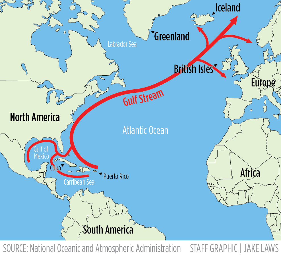
Over the past 20 years, the Gulf Stream has warmed faster than the global oceans and moved closer to shore, raising the possibility that the tropical ocean current could suddenly impact U.S. coastal fisheries, according to a new study published this month.
Physical oceanographers Robert Todd and Alice Wren of Woods Hole Oceanographic Institution found that the Gulf Stream has warmed by 2 degrees Fahrenheit and moved within 6 miles of the eastern continental shelf since 2001, according to findings published in the journal Nature Climate Change.
The Gulf of Maine is greatly influenced by the Labrador Current, which brings cold water from the north. The oscillating Gulf Stream generally passes 100 miles south of the Gulf of Maine’s southern border, but the separation of warm waters from it can still increase Gulf of Maine temperatures for months at a time.
Scientists say it’s too early to know for sure, but increasingly warm core rings breaking off closer to shore could have a significant impact on environmental conditions and marine wildlife within the Gulf of Maine, according to Todd, the study’s lead author.
“These rings have very sharp temperature contrasts,” Todd said. “They come in and suddenly you have very warm water where you had cold water before. It’s a temporary period over the life of the ring, but it’s a long enough period of time that the fish and shellfish will be interested in it.”
This study focused on the general Gulf Stream that hugs the US coast from Florida to Cape Cod, before flowing east toward Europe, but Todd points out that other researchers have found that the number of warm core loops formed by the Gulf Stream has nearly doubled since then. 2000.
The balance between Maine’s two dominant ocean currents is shifting, according to Dave Redmiller, director of the Climate Center at the Gulf of Maine Research Institute. He said the Arctic-filled Labrador Stream is no longer as cold as it used to be, and the Gulf Stream is warmer and wider than ever before.
The study’s findings are consistent with long-term ocean warming trends in the region, Riedmiller said. He noted that the Gulf Stream is not about to enter the Gulf of Maine — the Labrador Current remains the dominant influence in the region — but its warming and widening will certainly impact the Gulf of Maine.
“It is another sign that significant changes are underway in this major ocean current that will likely have long-term consequences for the Gulf of Maine and the communities that depend on it for their well-being and livelihoods,” Redmiller said.
Even small changes in temperature can have a big impact on some marine wildlife, including cold-water species such as herring, which are declining, and warm-water species such as squid and butterfish, which are both increasing. It’s not just fish, puffins are changing what they feed their chicks.
The Gulf of Maine, which spans 36,000 square miles northeast from Cape Cod to Nova Scotia, is warming at a rate of one degree per decade. This is four times the rate of warming of the global oceans, which are warming by a quarter of a degree every decade.
This was the eighth hottest summer in the Gulf of Maine since satellite data was collected, according to GMRI. It was a year of major temperatures for the larger North Atlantic region, which also contributed to higher temperatures on Earth.
With an average temperature of 63.6 degrees Fahrenheit, July was the warmest month in the Bay Area on record.
Researchers believe this trend is the result of an apparent shift in the system: a combination of a widening Gulf Stream, changes in the Labrador Current, and the weakening of a larger system of currents that keep the heat and energy of the northwestern Atlantic well mixed.
The Woods Hole study, which relies on more than 25,000 temperature and salinity observations collected over 20 years from gliders and underwater buoys, provided physical confirmation of Gulf Stream changes predicted by climate models, Todd said.
The buoys from the Argo program, which Woods Hole helped found in 1999, drift with ocean currents and collect data as they move up and down between the sea surface and 6,500 feet to the ocean floor.
The gliders move up and down like Argo floats, but they can also cross the Gulf Stream as it carries warm water from the tropics north to higher latitudes as part of the Atlantic overturning circulation.
Gliders and buoys take measurements of the subsurface ocean that satellites cannot, Todd said.
“Ex
the next ”
Related stories

“Typical beer advocate. Future teen idol. Unapologetic tv practitioner. Music trailblazer.”


Username/password is incorrect.
Please check your email to confirm and complete your registration.
Use the form below to reset your password. When you submit your account email, we will send you an email with a reset code.